San Luis Potosí
| San Luis Potosí Estado Libre y Soberano de San Luis Potosí |
|||
|---|---|---|---|
| — State — | |||
|
|||
 |
|||
| Country | |||
| Capital | San Luis Potosí | ||
| Municipalities | 58 | ||
| Admission | December 22, 1823[1] | ||
| Order | 6th | ||
| Government | |||
| - Governor | Fernando Toranzo Fernandez (PRI) | ||
| - Federal Deputies | PAN: 7 | ||
| - Federal Senators | Alejandro Zapata Perogordo (PAN) Eugenio Govea Arcos (Convergencia) Carlos Jiménez Macías (PRI) |
||
| Area Ranked 15th |
|||
| - Total | 63,068 km2 (24,350.7 sq mi) | ||
| Population (2005) | |||
| - Total | 2,410,414 (Ranked 16th) | ||
| - Demonym | Potosino | ||
| Time zone | CST (UTC-6) | ||
| - Summer (DST) | CDT (UTC-5) | ||
| HDI | 0.8160 - High Ranked 21st |
||
| ISO 3166-2 | MX-SLP | ||
| Postal abbr. | S.L.P. | ||
| Website | San Luis Potosí State Government | ||


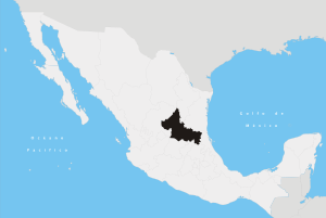
San Luis Potosí (Spanish pronunciation: [ˈsan ˈlwis potoˈsi]) is a state of Mexico, situated in the center of the country. It is bordered by Coahuila to the north, Nuevo León to the northeast, Tamaulipas to the east, Veracruz to the east, Hidalgo, Querétaro, and Guanajuato to the south, and Zacatecas to the northwest. At the 2005 census the population was 2,410,414.
In addition to the state capital San Luis Potosí, the state's largest cities include Ciudad Valles, Matehuala, and Rioverde.
Contents |
Etymology
The state and its capital are both named after Louis IX of France (also known in Mexico as San Luis Rey de Francia, Saint Louis, King of France), its patron saint. The Potosí was added in reference to the fabulously rich mines of Potosí, Bolivia, comparing the wealth of these mines to that of the local mines at Cerro de San Pedro.
Geography
San Luis Potosí is bounded on the east by Nuevo León, Tamaulipas and Veracruz, on the south by Hidalgo, Querétaro and Guanajuato, and on the west by Zacatecas. Its shape resembles a Scottish Terrier.
The state lies mostly on the Mexican Plateau, with the exception of the southeastern corner of the state, where the tableland breaks down into the tropical valley of the Panuco River. The surface of the plateau is comparatively level, with some low mountainous wooded ridges. The Sierra Madre Oriental runs north and south through the state, and separates the Mexican Plateau from the Gulf Coastal Plain to the east. The Sierra Madre Oriental is home to the Sierra Madre Oriental pine-oak forests. The Panuco River originates on the Plateau, and flows eastward through a gap in the Sierra Madre to drain into the Gulf of Mexico. The easternmost portion of the state lies on the Gulf Coastal Plain, and covered by the Veracruz moist forests.
The Panuco and its tributaries drain the southern and southeastern portion of the state. The northern and central portion of the state, including the capital, lie on an interior drainage basin which does not drain to the sea.
The mean elevation is about 6,000 ft., ensuring a temperate climate. The state lies partly within the arid zone of the north, while the southern half receiving a more liberal rainfall through the influence of the Nortes, which deliver significant amounts of rain. The rainfall, however, is uncertain at the western and northern regions, and much of the state is poorly provided with rivers. The soil is fertile and in favorable seasons large crops of wheat, maize, beans and cotton are grown on the uplands. In the low tropical valleys, sugar, coffee, tobacco, peppers and fruit are staple products. Stockraising is an important industry and hides, tallow and wool are exported. Fine cabinet and construction woods are also exported to a limited extent.
At one time San Luis Potosí ranked among the leading mining provinces of Mexico, but the revolts following independence resulted in a great decline in that industry. The area around Real de Catorce has some of the richest silver mines in the country. Other well-known silver mining districts are Peñón Blanco, Ramos and Guadalcázar. The development of Guadalcazar dates from 1620 and its ores yield gold, copper, zinc and bismuth, as well as silver. In the Ramos district, the Cocinera lode was said to have a total yield of over $60,000,000 in the first decade of the 20th century.
Municipalities
The State of San Luis Potosí is divided into 58 municipalities (Spanish: municipios), each headed by a municipal president (mayor).
Major communities
- San Luis Potosí
- Soledad de Graciano Sanchez
- Ciudad Valles
- Rioverde
- Matehuala
- Tamazunchale
Governors
The current governor is Fernando Toranzo (2009–2015) of the PRI party (Partido Revolucionario Institucional)
Economy
Traditionally, the Real de Minas potosino has driven the industrial engines in the state of San Luis Potosí, and as such, nowadays basic metallurgy still has the largest contribution within the Gross Domestic Product of the entity. The main products extracted across local mines are zinc, copper, lead, gold, silver, mercury, manganese, and arsenic. Other industries following the mining lead are in the sectors of chemicals, foods, beverages, tobacco, and textiles.
The services sector, also known as tertiary, is second regarding contribution to the state's income with a 21%, followed by commerce, hotels and restaurants with 18%. These combined activities employ 51% of the economically active population or EAP.
Agriculture is a traditional activity, still practiced in the Huasteca region. Currently, even if it contributes very little to the state GDP, it nevertheless employs as much as 20% of the EAP of the entity. The main agricultural products grown on Potosí soil are maize, beans, barley, sugar cane, oranges, coffee, sour lemon, tuna, and mango. Livestock activities are focused on raising sheep, cattle, and pigs.
General Motors now has a plant under construction, San Luis Potosí Assembly, to employ up to 1800 and assembly up to 160,000 vehicles per year.[2]
Cummins Inc. has had a manufacturing presence in San Luis Potosí since 1980 and employs nearly 2000 people there.
Demographics
The state of San Luis Potosí reports a population of a little more than 2,400,000 inhabitants, according to the latest census which took place in the year 2005. Population growth rate for the period 2000-2005 was in fact less than 1%.
The state is inhabited by 60% residents under 30 years of age, and reports a life expectancy rate similar to the national average, that is, 72 years for men, and 77 years of age for women.
Regarding cultural and ethnic diversity, as much as 11% of the state population has an indigenous origin, and the most representative language is that of the Nahuatl, followed by the Huasteco. The native peoples of the state are among the tallest in Mexico and include the Huastecs and Pame people. Due to its severe levels of isolation, the state is one of the nine entities in Mexico which report the highest rates of migration into the United States.
Education
The average schooling rate for those over 15 years of age lies at 7.7 years of education, considerably lower than the 8.1% found nationally, while illiteracy rates reach a high 9.2%, in addition to the facts that 28% of the same portion of those older than 15 never finished primary school, and that 4% of children under 14 years do not attend school.
Institutions of higher education include:
- Autonomous University of San Luis Potosí (UASLP)
Transportation
Ponciano Arriaga International Airport serves the city.
Notable natives and residents
Arts and sciences
- Julian Carrillo Trujillo - discovered the Thirteenth Sound, born in Ahualulco, San Luis Potosí.
- Francisco González Bocanegra - author of the Mexican National Anthem
- Manuel Jose Othón - poet
- Jorge Carrillo M.D.FACC, President of College of Cardiologists in San Luis Potosí.
Journalists
- Julio Hernández López - columnist of La Jornada
Politics
- Ponciano Arriaga
- Miguel Barragán - President of Mexico
- Carlos Jongitud Barrios
- Gonzalo Martínez Corbala - ambassador to Chile during the Coup
- Luis Ernesto Derbez
- Alfonso Lastras Ramirez
- Salvador Nava Martínez
- Francisco Xavier Salazar Saenz
- Antonio Rocha Cordero
- Gonzalo N. Santos
Sports
- Jorge Goeters, NASCAR driver
- Nery Castillo, professional football (soccer) player. He was born in San Luis Potosí and moved out when he was 3 months old)
- Mil Máscaras (Thousand Masks), professional wrestler
References
- ↑ La diputación provincial y el federalismo mexicano - http://books.google.com.mx/books?id=i_GK_-6deKIC&pg=PA227&lpg=PA227&dq=22+De+Mayo+De+1824+durango&source=bl&ots=eyvDzsrMIz&sig=zYxzmtG7gTQgGV-WNDfHgqcG_kU&hl=es&ei=FtAxS9joN56ltgf-_ojFDg&sa=X&oi=book_result&ct=result&resnum=1&ved=0CAgQ6AEwAA#v=onepage&q=22%20De%20Mayo%20De%201824%20durango&f=false
- ↑ "GM to produce Aveo at new Mexican plant, Stephen Downer, Automotive News". http://www.thegmsource.com/forums/index.php?showtopic=1287.
- Ricketts, Taylor H., Eric Dinerstein, David M. Olson, Colby J. Loucks, et al. (1999). Terrestrial Ecoregions of North America: a Conservation Assessment. Island Press, Washington, D.C..
![]() This article incorporates text from a publication now in the public domain: Chisholm, Hugh, ed (1911). Encyclopædia Britannica (Eleventh ed.). Cambridge University Press.
This article incorporates text from a publication now in the public domain: Chisholm, Hugh, ed (1911). Encyclopædia Britannica (Eleventh ed.). Cambridge University Press.
External links
|
||||||||||